
The Garmin nüvi 500 features driving, walking, cycling and boating modes which customise your nüvi specifically for your method of travel.
This portable hybrid combines the advanced navigation features and large, colour display found in automotive units with the durability of an outdoor handheld. Sleek and slim, you can slip the nüvi 500 into your pocket or backpack. The user-replaceable, rechargeable lithium-ion battery lets the nüvi navigate you on roads or off.
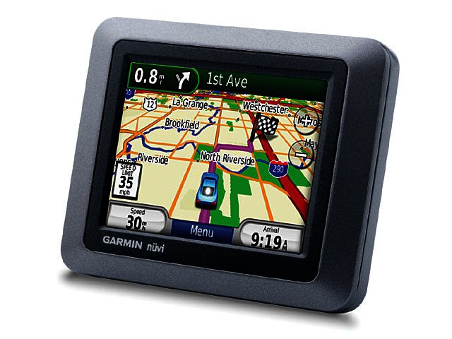
The nüvi 500’s intuitive interface greets you with two simple questions: “Where to?” and “View Map?”. Touch the colour screen to easily look up addresses and services and get voice-prompted turn-by-turn directions to your destination. It’s packed with tons of points of interest (POIs) and features digital elevation maps that show you shaded terrain contours at higher zoom levels. With the nüvi 500, you can upload custom points of interest (POIs) and navigate to geo-tagged photos.