Machu Picchu now available on Street View
By Staff Writer 4 December 2015 | Categories: news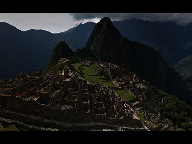
Related Articles

Good news for armchair tourists – the amazing city of Machu Picchu in Peru is now available to view in Google Maps. According to the Google Maps blog, the Historic Sanctuary of Machu Picchu, located 2400 metres above sea level, has been given the Street View treatment and is ready for exploration.
Part of the Inca Empire, it usually takes four days to trek to the top of this UNESCO World Heritage Site, with the city built round about 1450 but abandoned a century later.
All the important points can be accessed through a browser, including Templo Principal, Plaza Principal, Observatorio Astronómico (Intiwatana), Templo del Sol, Templo de las Tres Ventanas, and structures like the Grupo de las Tres Puertas. Machu Picchu was captured using Google’s Trekker equipment that is carried on the back of the camera person.
If wondering the different terraces and plazas are not enough, it’s also possible to delve deeper into the Inca culture, by visiting the Wonders of the city, with more than 130 Inca artefacts available for exploration.
Click on the video below for a bit of behind the scenes footage on the project. To start your journey, follow this link.
Most Read Articles

Have Your Say
What new tech or developments are you most anticipating this year?
